KML
KML stands for Keyhole Markup Language and is a file format used to display geographic data in Earth browsers such as Google Earth, Google Maps and Google Maps for Mobile. KML was developed for use with Google Earth, which was originally named Keyhole Earth Viewer. KML uses a tag-based structure with nested elements and attributes and is based on the XML standard. It contains boundary coordinates and placemark information for multiple zones.
There are three ways KML features can be used with SmartSimple.
- Upload a KML file to an XML field
- Enable KML on a custom field
- Use a System Variable to store a link to a public KML file
Uploading a KML File to an XML Field
Enabling KML on Custom Fields
KML can be enabled on the following custom field types:
- Dynamic Data – Dynamic Control Field
- Lookup – Entity and People
- Lookup – External Entity
- Lookup – External People
- Select Many – Check Boxes
- Select Many – List Box
- Select One – Combo Box
- Text – Password Protected
- Text – Multiple Lines
- Text – Single Line
- Lookup - NAIC Codes
- Lookup - ICD Code
- Special - XML Data
To do so, edit the custom field and, under General Options, select the "Enable KML" option:
![]()
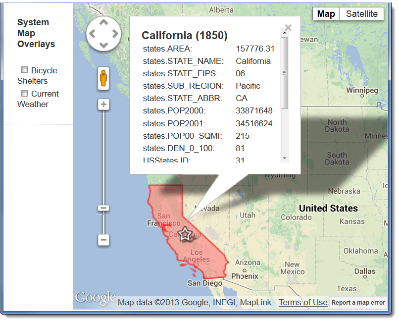
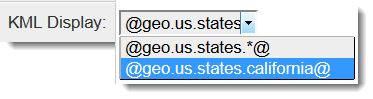
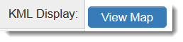
Fields that contain SmartSimple KML Variables will display as a "View Map" button in view mode:
|
|
|---|---|
| Field in Edit Mode | Field in View Mode |
In this case, California will be highlighted on the Google Map, and census information will be available.