Difference between revisions of "Custom Field Type: Special - Geo Mapping"
From SmartWiki
Nancy Sabo (talk | contribs) |
|||
| (2 intermediate revisions by the same user not shown) | |||
| Line 6: | Line 6: | ||
''Special - Geo Mapping (above)'' | ''Special - Geo Mapping (above)'' | ||
| + | ==Field Options== | ||
| + | All common options:<br /> | ||
| + | [[Custom Fields - General Information #General_Settings|General Settings]]<br /> | ||
| + | [[Custom Fields - General Information #Role Field Permissions and Status Field Permissions|Permissions & Availability]]<br /> | ||
| + | [[Custom Fields - General Information #Classic Options|Classic Options]]<br /> | ||
| + | For further information, please refer to [[Custom Fields – General Information]].<br /><br /> | ||
| + | Options listed below are specific to this particular field type.<br> | ||
| − | |||
| − | |||
| − | |||
| − | |||
* '''Drawing Options''': Enables the respective drawing options. | * '''Drawing Options''': Enables the respective drawing options. | ||
* '''Fill Color''': Color of area drawn. | * '''Fill Color''': Color of area drawn. | ||
| Line 17: | Line 20: | ||
* '''Stroke Width''': Thickness of strokes. | * '''Stroke Width''': Thickness of strokes. | ||
| − | |||
| − | |||
| − | |||
| − | |||
| − | |||
| − | |||
| − | |||
| − | |||
| − | |||
| − | |||
| − | |||
| − | |||
| − | |||
| − | |||
| − | |||
| − | |||
| − | |||
| − | + | [[Category:Custom Fields]] | |
| − | + | [[Category:Custom Field Types]] | |
| − | |||
| − | |||
| − | |||
Latest revision as of 14:05, 4 December 2018
General Description
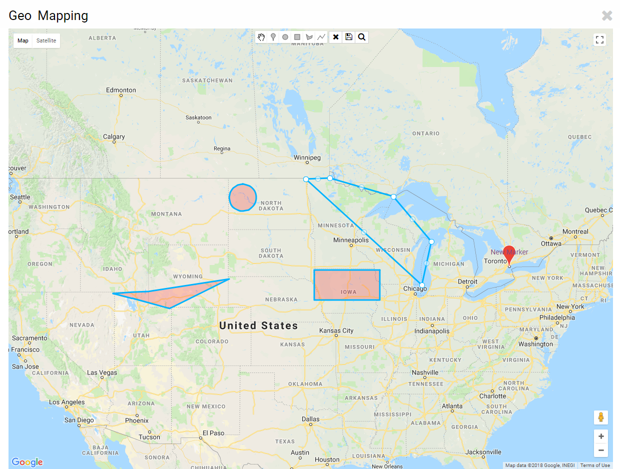
Geo Mapping enables the highlighting of geographic locations of your choosing.
Field Illustrated
Field Options
All common options:
General Settings
Permissions & Availability
Classic Options
For further information, please refer to Custom Fields – General Information.
Options listed below are specific to this particular field type.
- Drawing Options: Enables the respective drawing options.
- Fill Color: Color of area drawn.
- Stroke Color: Color of strokes.
- Stroke Width: Thickness of strokes.
